Goat Lake Loop with a Side Trip to Old Snowy
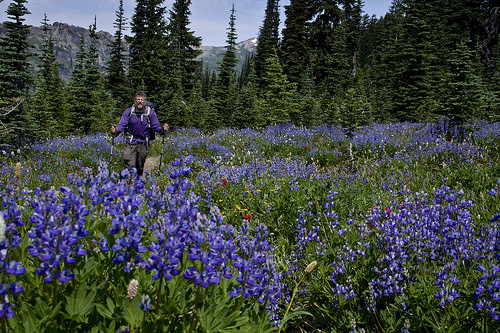
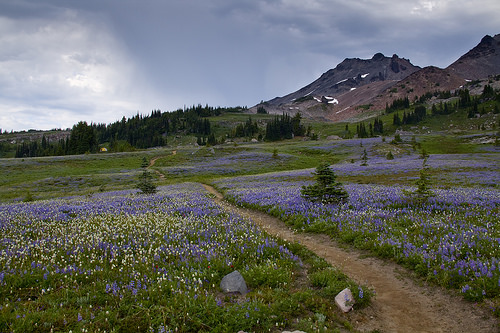
Entering Snowgrass Flats on Lily Basin Trail
Goat Rocks Wilderness is a 105,600-acre alpine paradise in the southwestern part of the Cascade Mountain Range. An ancient volcano once towered over the landscape reaching the height of over 12,000 ft that became dormant about half million years ago and since then eroded into several rugged peaks averaging about 8,000 ft.
Variety of hiking and backpacking trails is available. 15 routes totaling 120 miles criss-cross the region, including a 31 mile long segment of the Pacific Crest Trail which runs through the heart of the wilderness. At 6,900 ft the intersection at the base of Old Snowy is highest point of the PCT in Washington State.
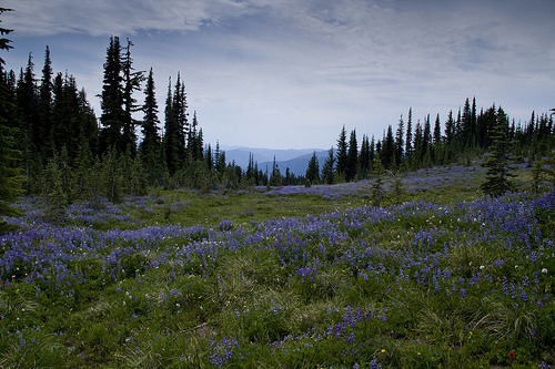
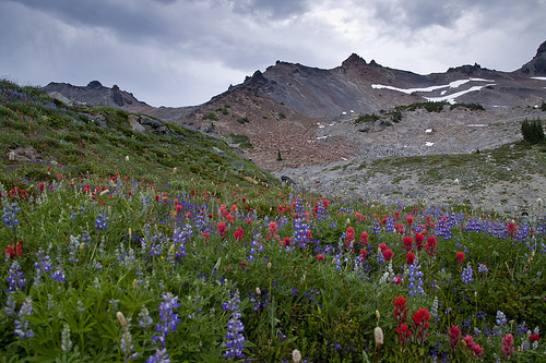
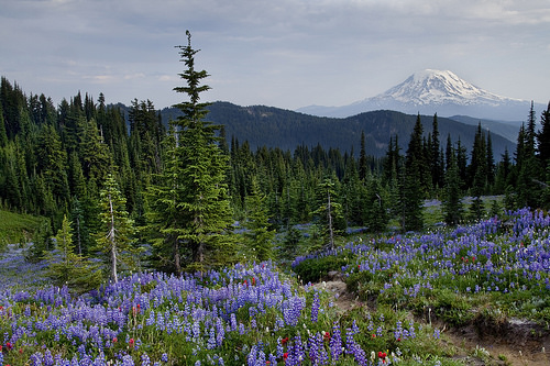
Purple meadows of Snowgrass Flats
Probably the most popular is Goat Lake Loop. With 12.8 miles of maintained trail and hills that never get too steep it is possible to hike it in one day but if you have two or three days in your budget, don’t hesitate to use them. The route will take you through never-ending wildflower meadows, around lakes and waterfalls and the views will stretching towards Mount Adams and Mount St. Helens are especially pretty in the evening when the hues of pink and purple color the sky.
For this loop I recommend parking at Berry Patch. Trees shade the parking area, keeping your vehicle cool and it is usually slightly less busy than the neighboring Snowgrass Trailhead which is the alternative. If spending time at Goat Lake is your objective, head up the Goat Ridge Trail, it will take you there faster; however if you plan to explore Snowgrass Flats hike the loop counter clockwise.
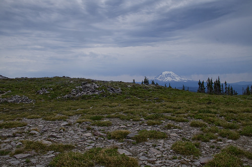
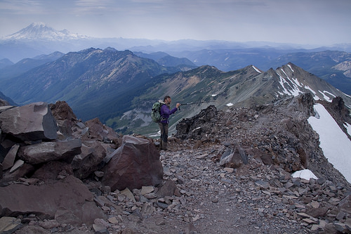
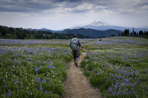
Mt. Adams from PCT which we hiked during a side trip to Old Snowy
The counter clockwise option will have you hiking 0.6 miles on a connector trail that will take you to Snowgrass Trail #96. It is a pleasant, nearly flat walk through a forest. The loop then continues through the forest on the same unchallenging grade with occasional uphill to scale. The canopy provides some shade but generally is open enough for sunshine to hit the forest floor. 4.3 miles after leaving Berry Patch you will come to an intersection with Snowgrass Bypass Trail #97. This trail would take you to Pacific Crest Trail. For Goat Lake Loop stay left.
At mile 5 ½ it’s time to leave the forest behind and enter a wonderland of alpine meadows and breathtaking views. This is the beginning of Snowgrass Flats. Interestingly you will also leave Snowgrass Trail here which continues up north to PCT and Old Snowy, one of the commonly climbed peaks in the Goat Rocks.
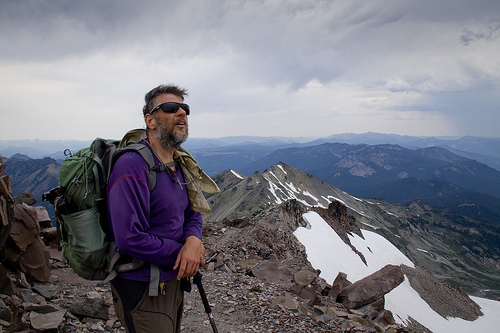
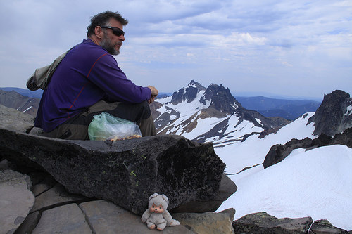
Dave scouting the route to the summit of Old Snowy.
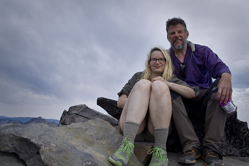
Succesfully summited Old Snowy. About a half day trip from Snowgrass Flats if you want to take sweet time to enjoy the views and take a lot of pictures.
Even our hiking buddy Moncici made it to the top. He was excited about being on the PCT, and can’t wait to hike the whole trail with us in two years.
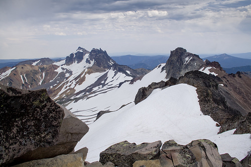
View from Old Snowy
Checking out the Knife Edge – one of the exciting parts of the PCT
Walking now on Lily Basin Trail your views will start expanding. And those are views that have the power to take your breath away. If you come during wildflower season you will be surrounded by butterflies and bees and the air around you will be filled with sweet honey-like scent of lupines. There are several very nice camp sites in the next few miles, if you are lucky you might even get one with a view of Mt. Adams. Site with the best view of Mt. Adams is about 6.1 miles from Berry Patch Trailhead. There are three possible sites along the side trail on hikers left, and the last one is the winner. To your right will be a side trail to another set of sites, water source, and an unnamed connector trail to PCT.
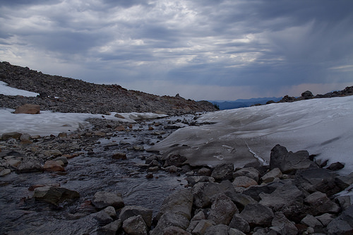
Lily Basin trail continues towards Goat Lake. The mile immediately before and immediately after Goat Lake will be the most alpine of the whole trail, and often snow will linger here late into the summer. Arriving at Goat Lake, mile 8, you will be greeted by amazing views towards Mount Adams. The water of the lake is emerald green when sun touches it and unless it is a very low snow season, there will be chunks of ice floating in the lake well into the season.
Camping is allowed at the lake but the sites are popular and you will have to arrive early to secure one. Please note that all sites in Goat Lake area are very exposed and not the best choice if weather forecast is questionable.
Weather threatened to rain in the afternoon.
Views along the PCT through Goat Rocks
Walking the trail when the flowers are out is such a treat.
Once you climb above Goat Lake, you will reach another intersection. Take Goat Ridge trail heading down into the basin where you can find several more campsites and Jordan Creek which is the last reliable water source. Fill up if your water up running low. You still have about 5 miles to go and even though the trail will start dropping you back into the forest, on a sunny day these 5 miles can be very hot and humid. At mile 12.6 you will arrive back at Berry Patch and your vehicle.
Last look at Old Snowy before dropping down to Snowgrass Flats again
View literally 20 ft from our camp. I wish you could smell the flowers.
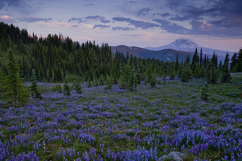
Peaceful sunset in Goat Rocks.
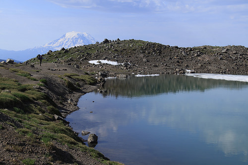
Mt. Adams seen from Goat Lake
Hiked: 6/27/15 – 6/28/15
Miles: 19 (including a side trip to Old Snowy. 12.6 for the loop only)
Elevation Gain: 5,841 (including a side trip to Old Snowy. About 2,500 for the loop only)
Wow!! It is just meadow upon meadow covered with wildflowers. With the stunning mountains surrounding them – what an amazing scenery to hike in. And then you get the view from the summit as additional bonus. Lovely!!
LikeLike
Astounding photos and wonderfully helpful narrative! You two are animals! Goats, perhaps?
LikeLiked by 1 person