Crater Lake Loop
Crater Lake, a gem of the Cascades, is nested in a caldera of Mount Mazama, dormant stratovolcano which was a part of the Oregon’s segment of the Cascade Volcanic Arc. During it’s last eruption in 5,677 B.C. which is said to had been 42 times bigger than the 1980 eruption of Mt. St. Helens, much of the volcano collapsed into its partially emptied neck and magma chamber. Over time rain and snow melt accumulated in the caldera basin forming the deepest lake in the United States. Lake that is isolated from surrounding streams and relies on precipitation as its sole input.
In 1902 Crater Lake was established as the 5th national park in US history and today the 33 mile long rim drive with its 30 pull outs and overlooks makes it easy for nearly half million yearly visitors to see the deep blue waters for themselves.
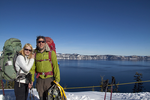
Ready to start the adventure
Dave and I are not particularly fond of overcrowded tourist attractions so there was never a doubt that winter trip would suit us better. In the winter snow closes the rim drive and the amount of tourists thins considerably. Most of those who still come don’t venture further than the first overlook which is 4 miles from the Rim Village and from there forward solitude can be found. It’s just us and miles of pristine snow through which we have to break trail.
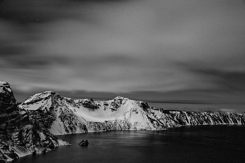
The first night we choose a camp with a view of the lake. It’s calm and quiet and there is no reason not to pitch on the open unprotected spot. It feels so late when the twilight dissipates but it’s January and the darkness falls early. It’s barely past 5:00 p.m. when first star appears on the sky.
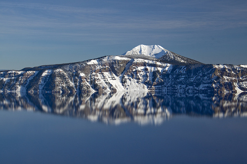
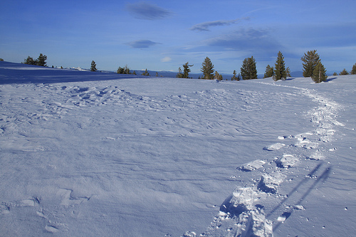
View just few miles into the hike
The second day of our adventure starts with a little bit of drama when wind picks up one of our pads and carries it over the rim. The pad lands on a steep crumbly slope about ten feet below the edge. Ten feet further the slope drops away into what I imagine being a 1000 foot void leading to the surface of the lake. I contemplate whether or not a rescue mission is worth the risk. It’s my secondary pad, one I brought while testing my new XTherm, just to play it safe. And while it is nice to have it, the XTherm seems to have R value high enough to keep me warm on the snow, just as the manufacturer promised, and my safety would not get compromised. In the end Dave decided to climb down and retrieve the pad. I don’t like the idea but before I can object he is already half way down.
The second day is physically the hardest. We plow through deep snow drifts and the road seems to be one never-ending uphill. There are viewpoints along the way but in between we walk through long quiet stretches of forest. Few hours into our hike we pass Cleetwood Cove Trail, the only route down to the lake’s shore that is safe and legal to take. During summer swimming is allowed from the shoreline at the bottom of the trail. Today the path is buried under snow. We don’t have the time to take it. Yesterday we stopped couple miles short of our planned destination and today we are trying to get back on schedule. If we are not more than halfway around the lake by lunchtime, we might need to consider turning around. But even if we had the time I doubt we would feel temptation to drop the 700 slippery feet down to the lake.
When lunchtime rolls in, we are not as far as we were hoping to be but we are far enough to have a good shot at completing the loop. We still have to break trail through the forested sections but in the open the road is windswept and easier to walk on.
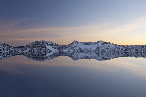
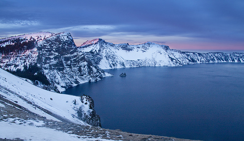
Evening at Crater Lake
Colorful sunset we enjoyed from our first camp site
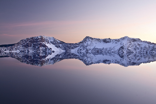
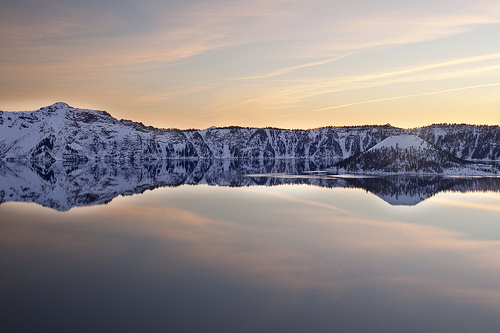
More colors to enjoy
Afternoon is breezy. I go from sweating to shivering in a very short amount of time but I stubbornly trudge against the wind without putting windbreaker on. I pay for it later. My body is so cold when we stop for the night that it takes two down jackets and a very long time for my teeth to stop chattering. The breeze grows in strength when evening approaches. Camping in the open does not seem a viable option for tonight. Trees are plentiful in the area and it is not difficult to find a sheltered spot to pitch our tent. Later in the night I lay in my sleeping bag listening to the wind moaning in the crown of nearby trees. Thank you wind for sweeping the road, thank you for making it so much easier for us to move forward, I whisper before I fall asleep.
On the last day the road takes us away from the lake. It meanders through more open terrain with views of mountains on the horizon. I like this section a lot. It has a feel of a cross country adventure rather than a road slog. Navigation can be tricky at times but eventually we always come to a spot where the shape of the snow laden road becomes more prominent reassuring us we are on a right track.
The road traverses two avalanche slopes today. They present the only avalanche danger along the whole loop. The first one is rather short. We cross it quickly, stepping over debris from previous slide. The second slope is much longer and the road slopes slightly uphill when it crosses it. Detour is available for times when avalanche danger is moderate or high. Today conditions are favorable and we can continue on the road. Still we take precautions and spread out so that in case slide happened only one of us would get hit by it and the other would be available to help.

Camp site with a view
We are just few miles from civilization when a group of three skiers passes us. They are the first people we see in nearly two days. We expected the lake to be busier with winter recreationalists, the forecast was spotless. But the solitude was nice and we liked the idea to be the first ones to complete the loop in 2015. We lost that title in the finish line but at least we still are the first snowshoers to complete the loop this year.
Crater Lake Loop is a great winter adventure. It’s difficulty depends on many factors. Conditions play a role. So does the size of your group and the amount of days you take to hike it. If you are in a decent shape three days on snowshoes or two days on skis are doable. Adding a day would allow for more exploration and if you can alight five days trip with a good weather window you’ll have a very nice leisurely stroll.
Overnight permits are free and can be obtained at the Steel Visitor Center located at the park headquarters.
Crossing an open plateau on the east side of the lake
Windy night at camp site #2
Soft morning colors
DIRECTIONS:
From the South (Year Round):
From Medford – Route 62 north and east to the park’s west entrance.
From Klamath Falls – Route 97 north to Route 62 north and west to the park’s south entrance.
Hiked: 1/1/2015 – 1/3/2015
Distance: 33 miles
Elevation Gain: 3,800 ft
What a beautiful scenery! I would love to visit this spot. It is so stunning I could probably survive the crowds in summer:) The skiers you met, did they actually ski around the crater? I would love to do that! But looking at the pictures it seems like the terrain could be a bit difficult for skiing?
LikeLiked by 1 person
Thanks for stopping by.
The ski route follows the same road we snowshoed on. The crater is quite rugged and cliffy at places and it would not always be safe to stay close to it. Also, parts are forested which would not be fun for skiers.
There are plenty of opportunities to enjoy the views. The loop stays close enough to the lake, especially the first half, and has 30 overlooks.
If you ever have a chance to visit, I highly recommend it.
LikeLiked by 1 person
I will have to put in on my list for sure. Did the skiers go on cross country skies or touring/alpine skis?
LikeLike
I’m not 100% sure. As a non skier I usually don’t pay much attention. They looked wider and rounder than cross country skis. though.
LikeLiked by 1 person