Observation Rock

Heading towards Observation Rock in search of campsite
Of the trails starting from the Mowich Lake entrance of Mount Rainier NP, Spray Park is the most popular choice. If you asked, many hikers would admit the views of Mt. Rainier looming over the corridor of the never-ending flower carpeted meadows lure them back over and over again.
From the trailhead the path drops quickly to a junction with Wonderland Trail and then starts a gradual climb through sun filled forest. Eagle’s Cliff Overlook offers the first opportunity to take a break with a view. You will get a spectacular peek at Mount Rainier and the Mowich Glacier from here. Later you will find a short spur trail on the right leading down to Spray Falls. This is a worthwhile side trip which only adds a total of 0.5 miles to your trip.

Little bit of rain hitting an area nearby
Once you return from the falls, the trail continues it’s uphill course now on a series of somewhat steep switchbacks. This section is approximately ¾ mile long and it is the steepest slope you will find along the trail. Once you are done with it, the rest is a breeze. The trail still proceeds uphill but now on more gentle grade. You will cross Grant Creek and shortly afterwards the forest opens into broad fragile subalpine meadows dispersed among rocky moraines and the views will include Hessong Rock to the north and the snow capped cone of Mount Rainier to the southeast. The further up you go, the more the views will WOW you. Come during wildflower season, usually in August, and your eyes will find it difficult to choose between looking up and looking down. About 3.5 miles from the trailhead where Spray Park borders with Seattle Park beautiful rock garden awaits at 6400 feet where you can admire the most incredible tiny flowers thriving in this harsh environment. This is where most day hikers turn around.
The weather is incredibly generous to us this summer. We are on a third sunny weekend since our return from California, and a sunny weekend in Washington State has to be taken advantage of. So here we are again sweating the uphill with overnight packs on our backs.
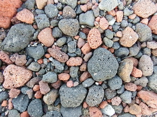
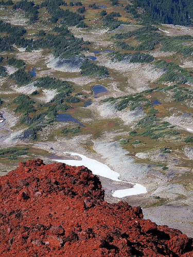
Colorful rocks often found in Spray Park
If you looked from Spray Park towards Mt. Rainier, two prominent bumps would catch your eye. The slightly lower and harder to climb is Echo Rock. The other one, Observation Rock, has a well beaten path leading to its summit. There is minimal exposure if you stick to the route and as its name suggests the views from the top are incredible. Observation Rock is the objective of our trip.
To get there one can hike to the highest point of Spray Park, it’s at the same area Wonderland Trail takes off towards Cataract Valley, and follow a boot path on the ridge towards Echo Rock.
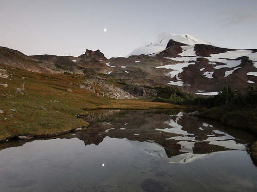
Several good campsites can be found just before the vegetation disappears. They are mostly small sand pits suitable for one tent that would have a water source nearby in a form of a tarn. The site that catches our attention also has a great view of Mt. Rainier and both Rocks. We stake our claim, carefully watching a storm front nearby. We did not expect to see any rain this weekend but it’s the mountains, the weather comes and goes, and it hardly ever has much in common with what the forecast promised.

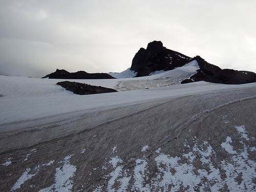
At the tip of Flett Glacier

The sunshine returns in the late afternoon

One of the views from our campsite
Same scene so peaceful during moon rise

Campsite in the evening
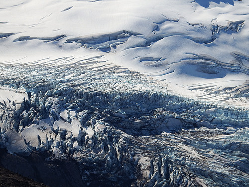
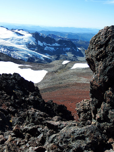
There are few drops hitting our tarp but the rain never really reaches us. The clouds are blown apart by the time afternoon rolls in and the sun is out again bathing us in it’s warmth. It’s too late for the climb but we have enough time to explore the first part of the route. The path often dissipates in the rocky terrain but with the destination in plain sight it’s easy to keep on course. Since we did not bring crampons for this short afternoon excursion we decide to stop when there is nowhere else to go then to hop onto Flett Glacier. It’s a beautiful area to enjoy. Glacial melt collects in a pool by the snout. Few pieces of ice float in it like icebergs in a sea. And behind the cold tones of the ice Echo Rock raises high to the sky showcasing it’s reddish hues.
Next morning finds us at the very same spot. This time we are equipped to proceed further, crampons, ice axes and all. Flett Glacier is stagnant and at this time of the year any crevasses it holds are wide open and visible from afar. There are none to be seen on our route which leads us straight across the glacier where boot path once again picks in the crumbled rock.

Gearing up before crossing Flett Glacier
Our destination

View from the route
The last obstacle we face is a 10 foot tall wall of hard consolidated snow. I brave it first, the snow sprays as I try to kick steps in. The sun is out and I suspect the snow will be softer at the time of our descend and though easier to negotiate but I do not want to rely on that assumption. The better steps I kick in now, the simpler it will be to downclimb this section if the snow does not soften enough.
The rest of the climb is straightforward. Narrow path in a loose pumice covered slope takes us all the way to the summit from where we have prime views of the north faces and glaciers of Mt. Rainier. and a vast area surrounding the mountain. It can’t get much better!
Hiked: 10/4/2014 – 10/5/2014
Distance: 18.5 miles
Elevation Gain: 7,638.00

Atop Observation Rock

View from the top
Close up view of glaciers on Mt. Rainier
If you look very carefully you can see the orange dot of our tarp
Yet another view from Observation Rock

Last look back as we are leaving Spray Park
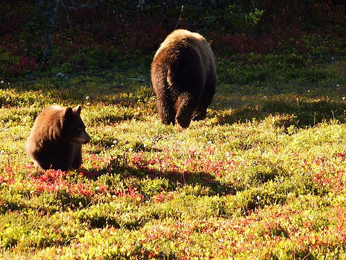
Mama bear and two cubs were feeding on blueberries few feet from the trail.
DIRECTIONS:
To get to Mowich Lake you first want to find a way to the little town of Carbonado northwest of the park. From Carbonado, drive Hwy 165 south. In three miles the road will cross over the Carbon River on a high, narrow bridge. In another 0.6 miles you will come to a fork. The left fork goes to the Carbon River Entrance to the park (if camping you will have to visit the ranger station here for overnight permit first). The right fork (Mowich Lake Road) goes to the Mowich Lake Entrance. Take the right fork. The road reaches Mowich lake in about 17 miles.